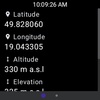
Discover an indispensable tool for outdoor enthusiasts - My Altitude and Elevation GPS. With an intuitive, easy-to-use interface, this application leverages your device's satellite GPS to display precise location-based data, including latitude, longitude, altitude, and elevation at any given point.
You'll appreciate the versatility of viewing coordinates in multiple formats, such as sexagesimal (DMS), decimal minutes (DMM), decimal degrees (DD), Universal Transverse Mercator (UTM), and Military Grid Reference System (MGRS). This ensures that, regardless of preference or requirement, users have the necessary information readily available.
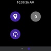
Whether you're hiking, camping, or just exploring the great outdoors, the app allows for seamless synchronization with Wear OS watch devices, enabling location saves directly from your wrist. Additionally, enjoy the luxury of revisiting saved locations on a larger screen for a clearer view of your trails and destinations.
Top features include the ability to share your location with ease, customizable photo information overlays for boastful social media posts, and a vast array of unit preferences, from meters to nautical miles. Plus, a handy tutorial is available to help navigate through its features.
Embrace the convenience of exporting your data in KML and GPX formats for detailed record-keeping, and be assured of your privacy, detailed in the application's privacy policy and terms and conditions.
Keep in mind that for optimal performance, a clear GPS satellite signal is required, which is typically unavailable indoors and may vary in accuracy depending on your device. A data connection is necessary to access elevation information. This ensures users stay informed at all times, from sea level to the highest peaks.
Elevate your outdoor experiences with a tool that puts essential geographical information in the palm of your hand – My Altitude and Elevation GPS.
Requirements (Latest version)
- Android 6.0 or higher required










Comments
There are no opinions about My Altitude and Elevation GPS yet. Be the first! Comment